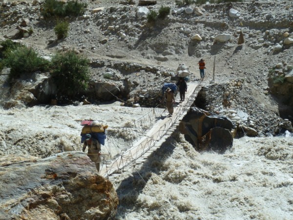
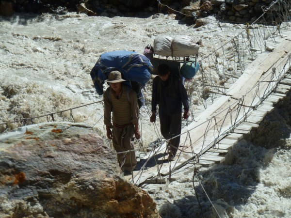
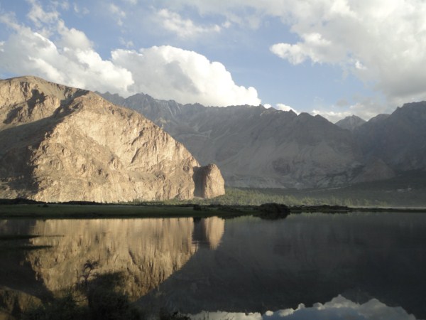
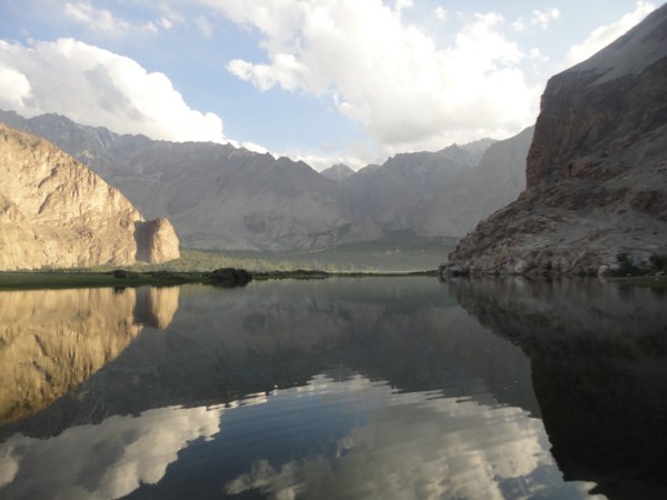
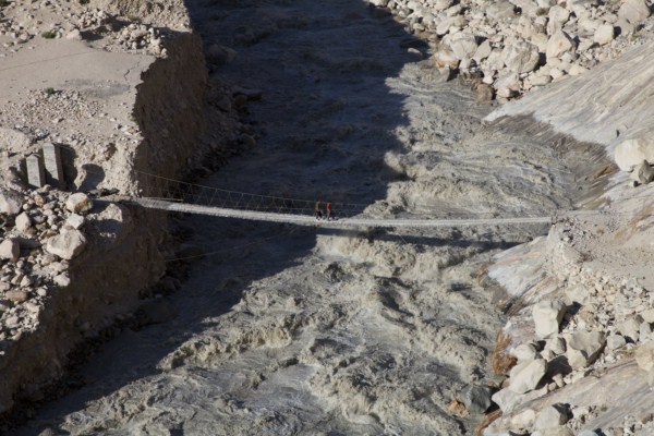
Rafting in Gilgit-Baltistan
In the Gilgit-Baltistan Region of Pakistan is Situated the Largest glaciered area outside Polar Regions melting of ice in summer create roaring white water streams and mighty rivers. Water courses of kaghan, swat, hunza, punail, shigar, broldo, shiyok and mighty Indus has no competitors’ to match to. The river courses are still not yet graded so white water sports in the peak of summer are recommended only for professionals.
Gilgit River
The lower Gilgit was first rafted by the Lowell Thomas expedition, after the Indus itself proved to be too much. The lowermost stretch is milder than either the Indus or the Hunza. There are still large holes and waves, but they are more readily avoidable. Views of Nanga Parbat are spectacular.
Braldo River
Known to generations of climbers from the trek in to the Baltoro Glacier between K-2 and Mashebrum, the Braldu was one of the first whitewater rivers attempted in Pakistan by Mike Jones in his fatal 1978 attempt. It is still one of the most difficult: remote, technical class 5-6, locked with in vertical canyon walls, and highly weather dependent.
The Braldu is fed by the largest complex of mountains glaciers in the world. From the moments the spring melt begins in May, its narrow gorge is filled with completely unrunnable thousands of cfs. It can only be reasonably approached during the off season.
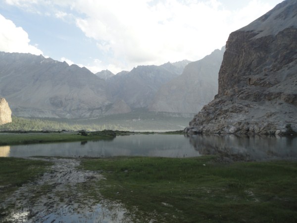
Hunza River
Before the 1970's when the combined efforts of the Chinese and Pakistani governments produced the Karakoram Highway on of the most dramatic engineering feats in the modern world the Hunza Valley was among the remotest regions on earth. Earth travelers journeying above Gilgit to capital, Karimabad reported a foot and mule path cantilevered out from the cliff face on logs sunk into cracks in the rock, hundreds of feet above the river.
Perhaps because of its inaccessible, almost legendary reputation, Hunza became one of the regions, along with certain areas of the high Andes and Tibet, where the inhabitants were rumored to live for hundreds of years. In fact, a healthy lifestyle emphasizing, by necessity, steep aerobic climbs everywhere they go, are a diet in which fruits and grains predominate, does produce remarkably fit and long-lived population.
The last portion of the river, before it meets the Gilgit and thence the Indus, has uniform 30 foot per mile gradient. By June, its flow was upto 30,000cfs, the holes and explosion waves assuming dangerous size. Sneaking is possible but even that requires efforts to avoid being funneled to the center by diagonal waves leading from the shore. Ten to 15 portages are required, and 2 days are best allocated board this run.
Typical of this region, the big Hunza Valley is barren and rocky, extremely hot at low elevations, dominated by windblown dust in the air and silty rock flour in the water. it is a land of huge scales, with peaks like 25,550 foot Rakaposhi hanging over the powerful rivers. It is challenging and awer-inspiring, but no one would call it inviting or embracing, as are many of the rivers of Kashmir and other parts of the Himalaya.
Chitral River
The Chitral River properly begins six kilometers north of the town of Chitral, at the confluence of two primary tributaries. The Mastuj River flows down from the northeast, from the high pass into the upper Gilgit River system. The Lutkho the high pass into the upper Gilgit River system. The Lutkho descends from the northwest, from the passes leading into descends from the northwest, from the passes leading into Afghanistan. Their confluence forms a major river set in a wide, fertile valley, flowing south and west, eventually to cross the border into Afghanistan. Joining the Kabul River at historic Jalalabad, it reemerges nto Pakistan to meet the Indus at Attock Fort. As with the Indus and the Jhelum, flows are measured in thousands of cubic feet per secound.
Indus River
The Indus is one of the great rivers of the world, a supreme (and dangerous) challenge on par with climbing k-2, Nanga Parbat or Pakistan’s other mighty peaks.
The Indus rises in that mysterious region of western Tibet, where from origins with in a few miles of each other, the Brahmaputra flows east to envelope Bhutan and Sikkim before plunging through the Himalayas to the sea, while the Indus flows west in similar fashion in a huge crescent between the western subcontinent in an embrace thousands of miles in length.
Coursing through Tibet and Ladakh, the Indus enters Baltistan to dominate Pakistan. It absorbs tributaries carrying every drop of water that falls in the country. The larger tributaries (Kabul, Jhelum, Sutlej) drain portions of neighboring Afghanistan ad India as well.
40 kilometers from Keris to Skardu.
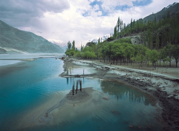
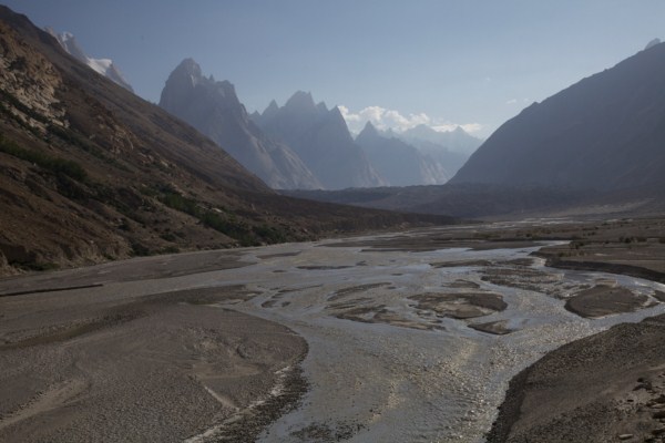
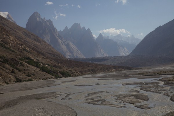
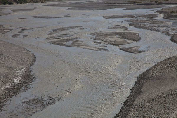
Shigar River
Nine kilometers below dasso, on the Braldu, the Basha River joins from the right, and the combined flow forms the Shigar River, flowing into the Indus at Skardu. The river is braided around sand and gravel bars, but at high snow melt levels it moves quickly. Huge surfing waves from over sand waves on the river bottom. The valley is wide and rich with agriculture wherever irrigation is possible. The ferry across the Indus to take out at Skardu is strenuous.
Shyok River
The Shyok as it meets the Indus River is a huge river its own right, the largest tributary of the upper Indus. It paralleled by roads on both sides of its wide lower valley, an for most of the first ten kilometers it is wide and relative flat. By late May, however, it is swollen by snowmelt to many thousands of cfs, and its power warrants respect. Most of the secound half of the run is big water class IV, and four carries may be required